
Project Type:
Freelance
Client:
Scope of Work:
Illustration
Print design
Tools:
Adobe Illustrator
Procreate
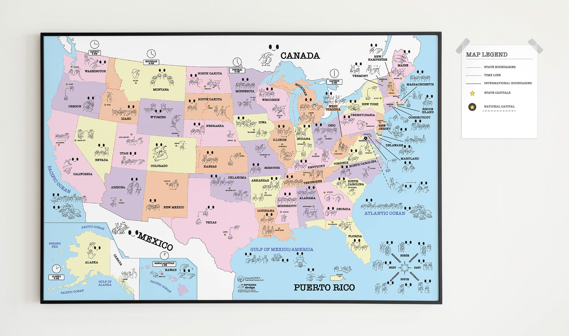
The USA Map in an ASL is the first kind of map visual that represents the U.S. states, state capitals, and North American geography through ASL hand-shapes and English. By combining geographic information with visual language, the design creates an inclusive learning experience that helps all Deaf learners connect with geography through both language and imagery.
Problems
Most open-sources USA and World maps limit visual language access for new Deaf learners. Visual language maps are an important learning resource for Deaf learners in both educational and professional settings. However, Deaf students and homeschoolers are often left out of educational resources, leaving them without access to visual learning materials in their native language, American Sign Language (ASL). This is especially important for Kindergarten and first-grade students who are beginning to learn about the United States and how to read and understand geography and map, and also, they begin to approach by learning a new vocabulary in sign language. The lack of ASL-inclusive instructional materials creates language barriers for Deaf, Hard-of-Hearing, and KODA (Kids of Deaf Adults) learners and limits equitable access to educational content.
Solutions
By incorporating the visual assets on the map as a visual learning tool, I began designed tons of assets that brings together American Sign Language (ASL) and English to make geography more accessible and engaging.
Outcome
This visual map supports new Deaf learners by accelerating comprehension, receptive, and strengthening essential skills, including fingerspelling, letter recognition, and writing proficiency.
Concepts
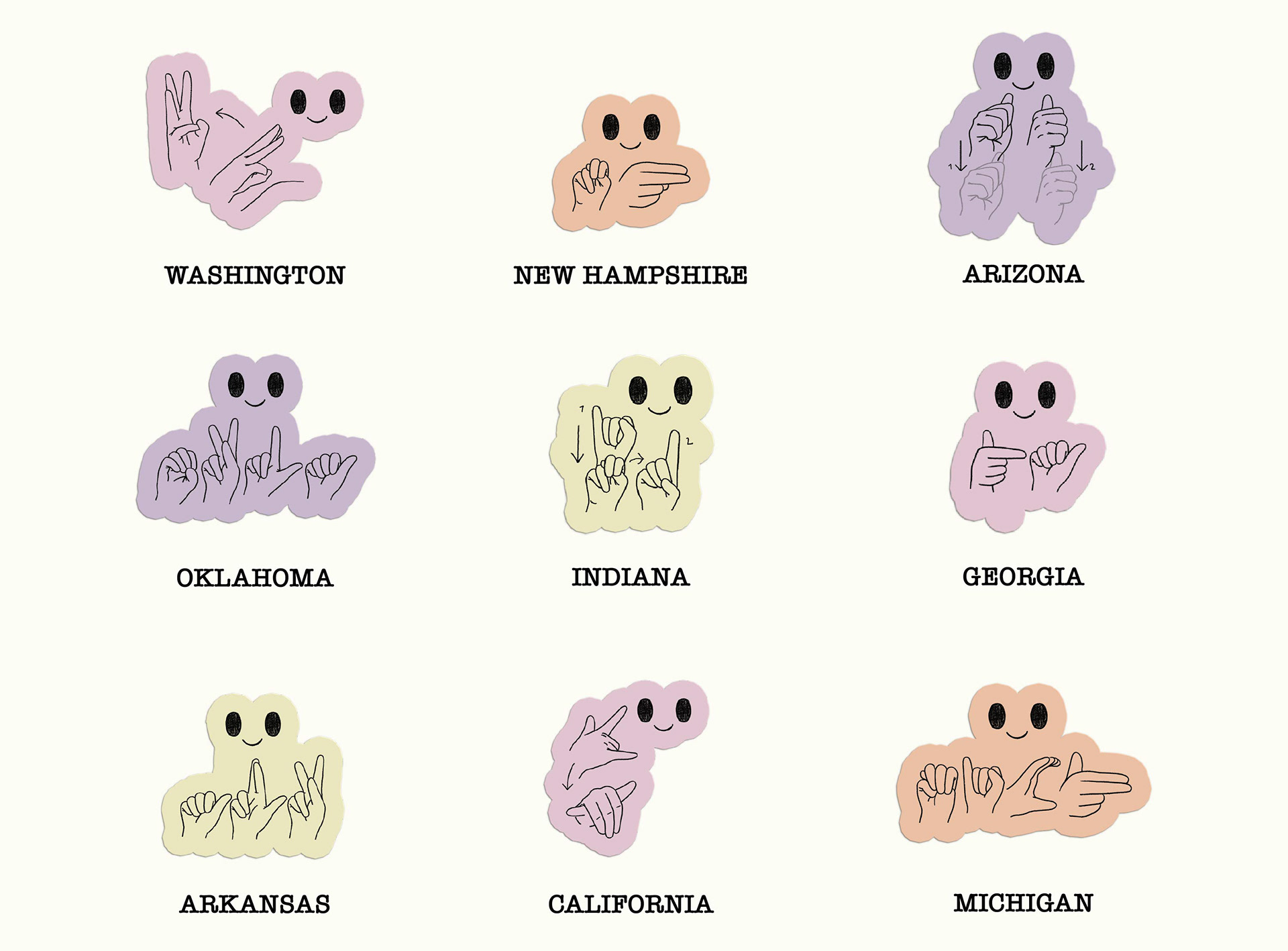
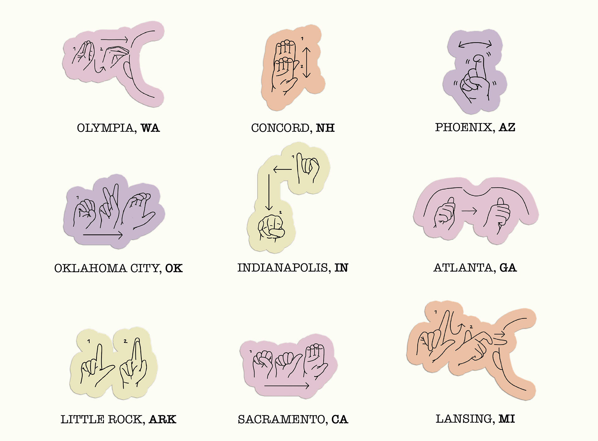
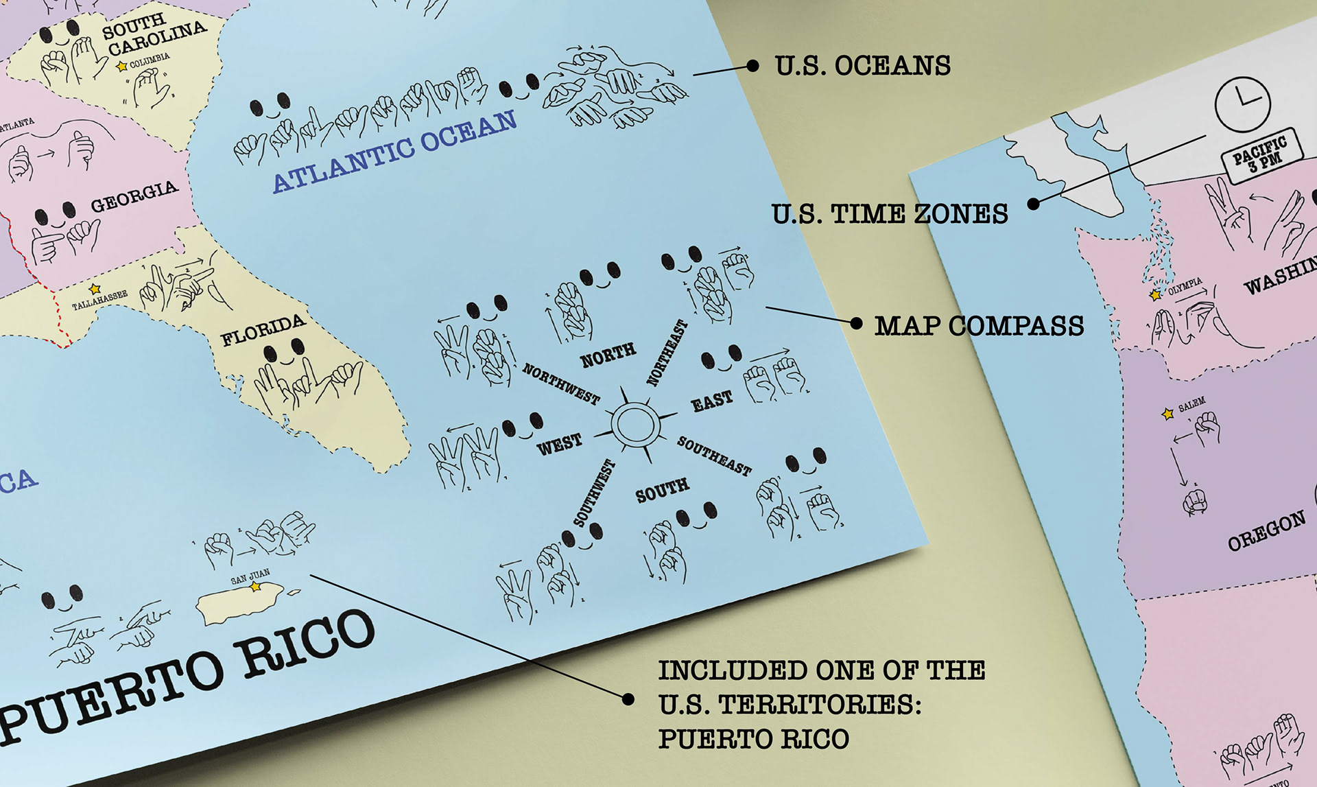
There are more than 50 illustrated elements in ASL where each State indicated their own sign for each state and their capitals all over the U.S, including U.S. oceans, and one of its territories.
The State version features the primary character representing each state, with a smiling face and the character signing the state name in American Sign Language (ASL). In contrast, the State Capital is represented as a secondary element using only the ASL handshape in the following each state.
- U.S. States in ASL -
- U.S. State Capitals in ASL -
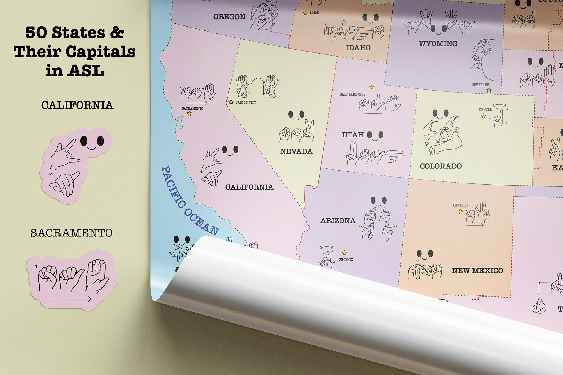
The visual map also included Canada and Mexico countries, U.S oceans, U.S time zones and one of its territories, Puerto Rico, and map compass in ASL.
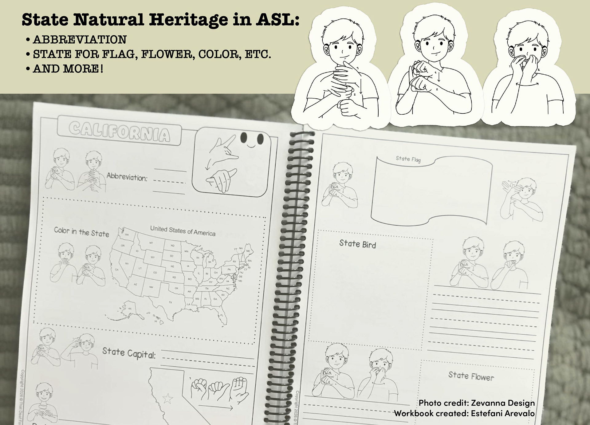
- The 50 States Study Unit in ASL Workbook -
My client developed the workbook that also incorporating visual assets. I designed the visual assets themselves, including an illustration of a figure (person) using American Sign Language (ASL) to represent the term "state natural heritage."